Inspection programs
Review imagery, AI detections, thermal evidence, annotations, and status for asset condition workflows.
SmartData gives power, telecommunications, mining, forestry, environmental, infrastructure, and construction teams a clearer way to turn drone capture into reviewable evidence.
Industries
5
Data types
8+
Workflow
Capture to report
Each workflow is written around practical asset problems: powerline evidence, tower inspection, mine site context, forestry monitoring, infrastructure progress, and drone mapping.
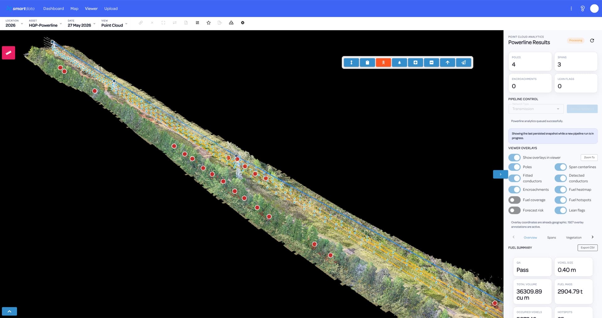
Utility teams need more than capture. SmartData keeps powerline inspection evidence, review status, spatial context, and reporting together so asset owners can move from defect discovery to planned action.
View page
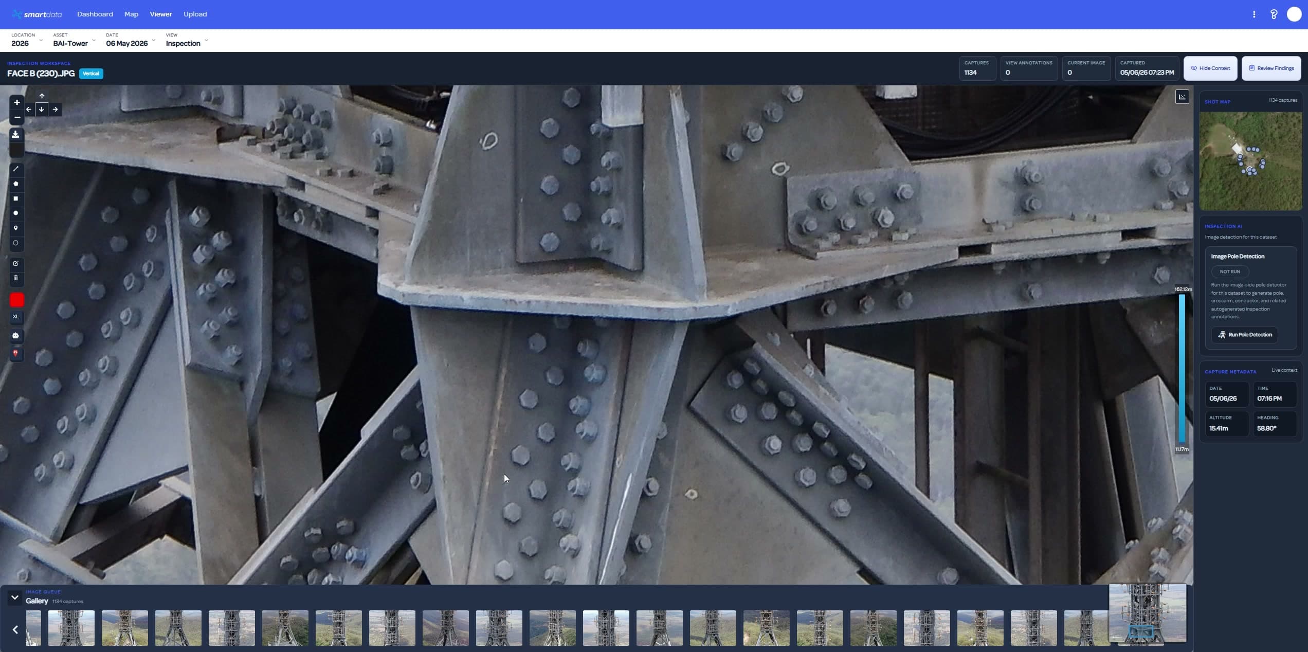
Telecommunications inspections create high-value visual and spatial evidence. SmartData helps asset owners, engineers, and contractors keep that evidence organised around the site, asset, and decision.
View page
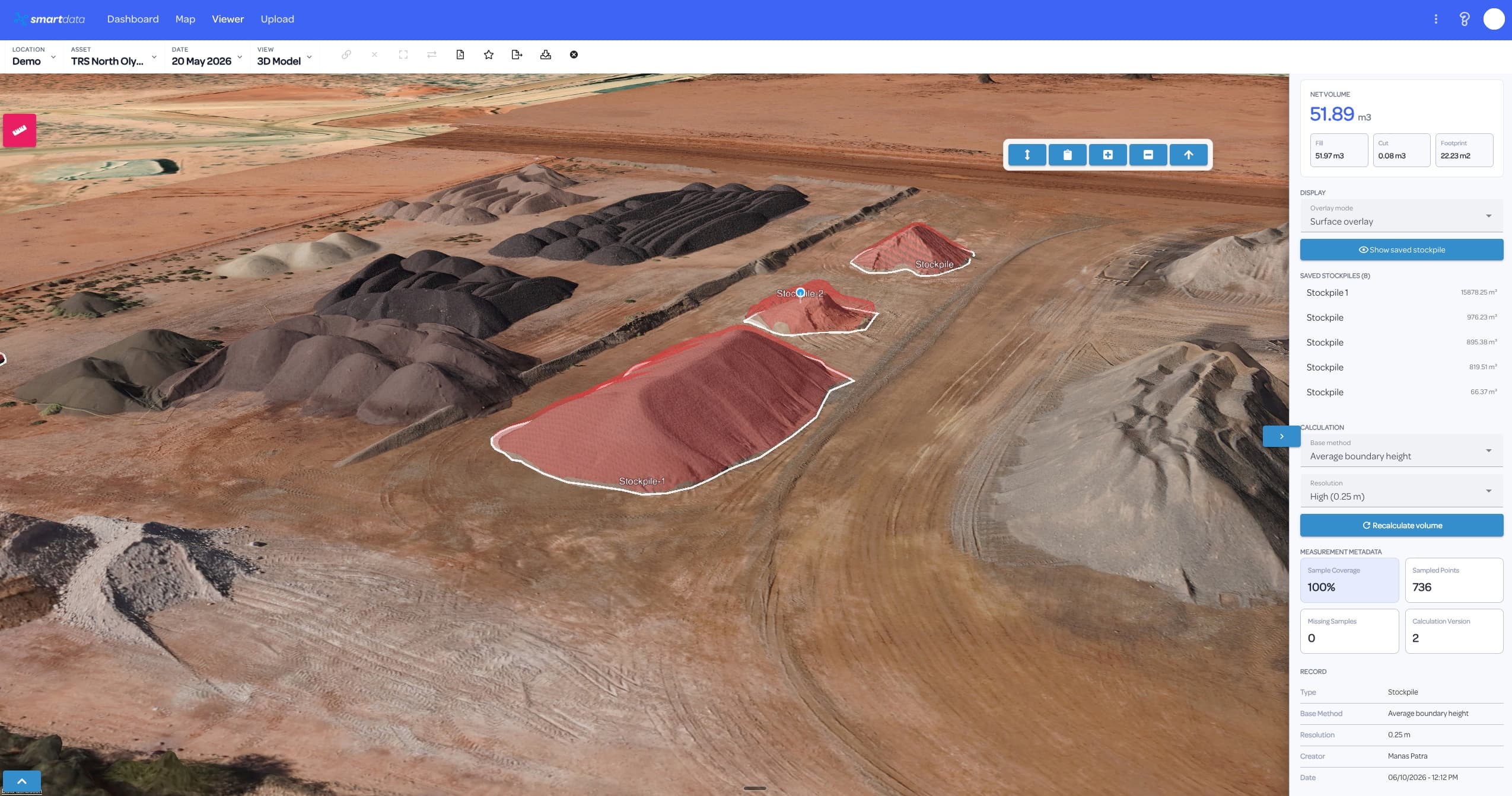
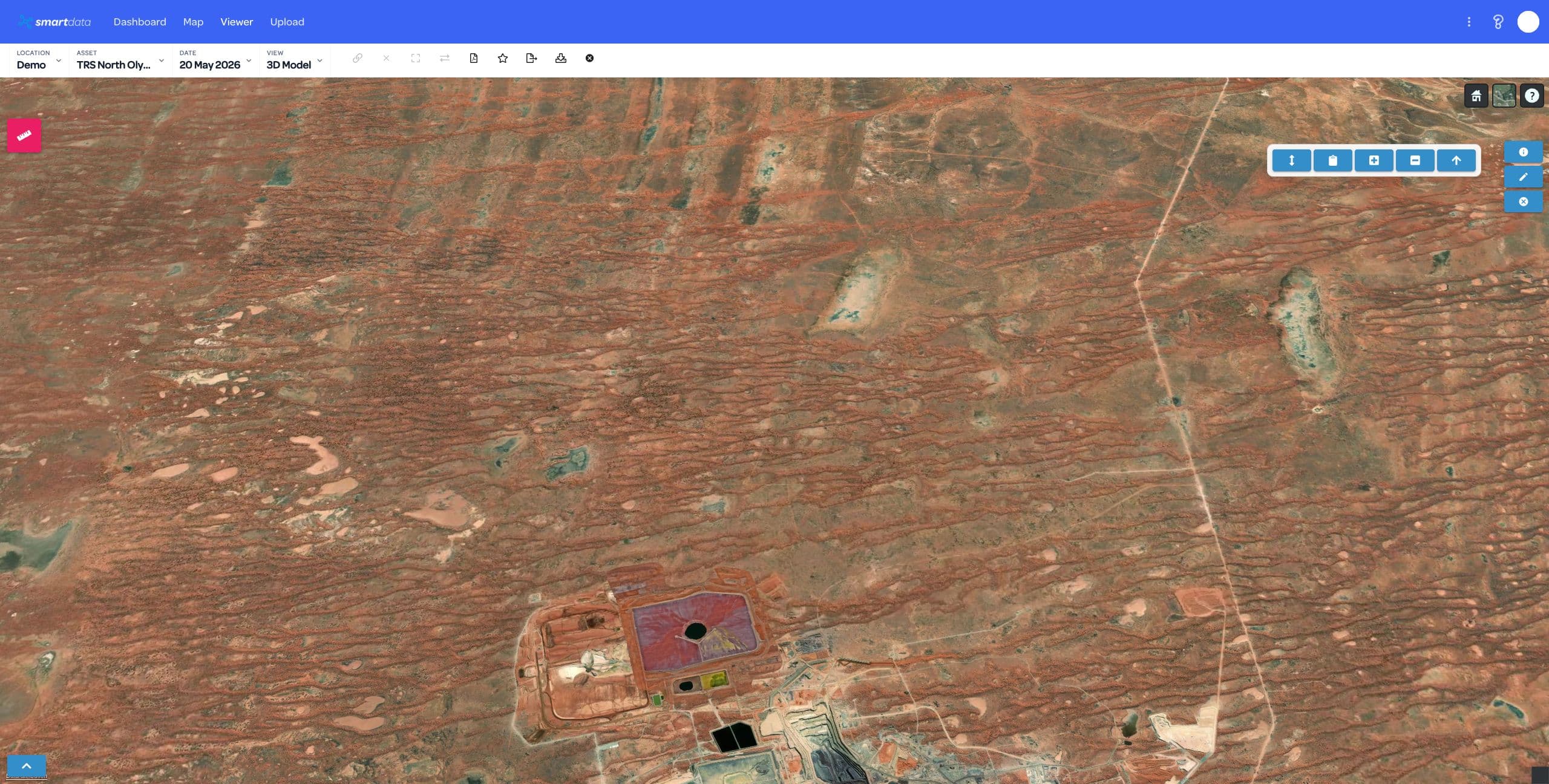
Mining and resources teams need repeatable spatial evidence across fast-changing sites. SmartData keeps maps, measurements, models, inspection records, and reports connected to the decisions they support.
View page
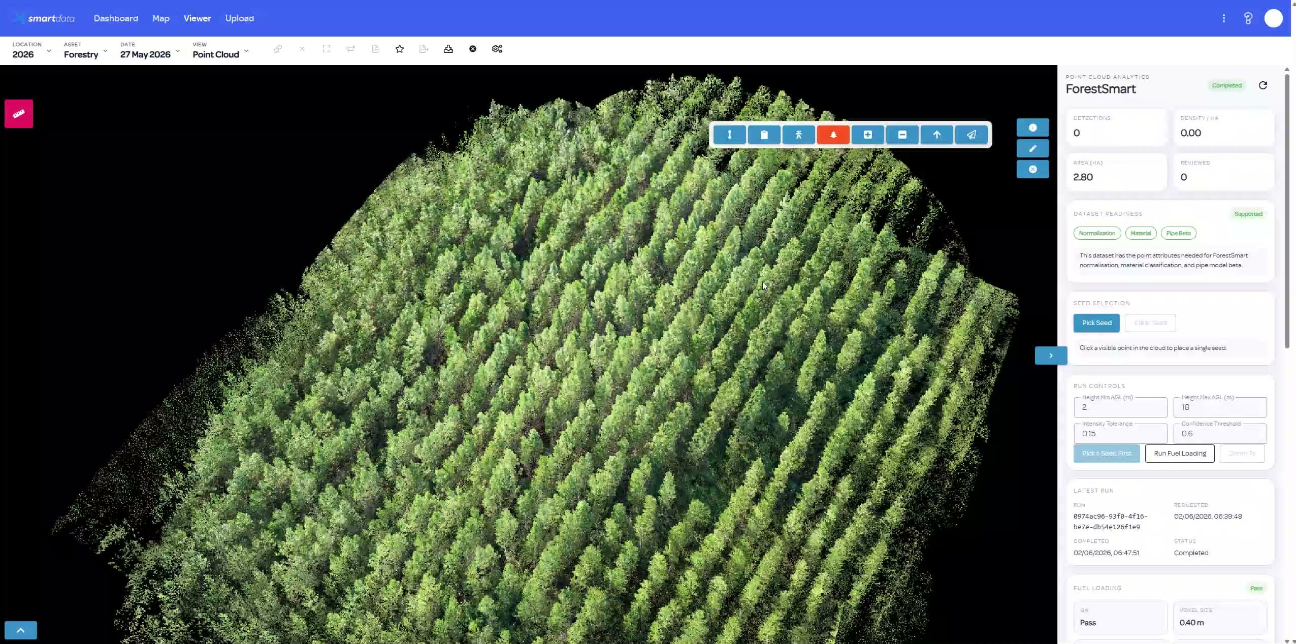
Forestry and environmental programs often rely on repeat captures, vegetation context, and field evidence. SmartData turns those datasets into accessible maps, review workflows, and reports.
View page
Infrastructure and construction teams need current site truth, clear progress evidence, and inspection records that survive beyond a file transfer. SmartData gives that evidence a shared home.
View page
Each industry view connects the asset problem to the SmartData software surfaces that support review, measurement, reporting, and team handoff.
The language changes by industry, but the underlying need is consistent: organise the dataset, review the evidence, and produce a decision-ready output.
Review imagery, AI detections, thermal evidence, annotations, and status for asset condition workflows.
Use hosted maps, terrain, 3D models, point clouds, and Gaussian Splat views to make drone outputs easier to interrogate.
Preserve project context, comparison views, reports, exports, and review history across repeated capture cycles.
SmartData gives each asset team a relevant entry point while keeping the workflow consistent: organise the dataset, review the evidence, and produce a decision-ready output.
Bring inspection imagery, maps, models, thermal data, point clouds, terrain, and splats into the same workspace.
Use the asset, corridor, site, or environmental workflow that matches how your team already makes decisions.
Turn reviewed data into reports and exports that engineering, maintenance, operations, and leadership can use.
Bring a sample dataset, inspection workflow, or corridor problem. We will map the right SmartData path and show where the sandbox experience can support your own asset workflow.