Tower condition review
Review tower imagery, attachments, equipment context, and inspection notes in a workspace designed for repeat asset programs.
Give telecommunications asset teams a governed workspace for tower imagery, antenna context, site maps, 3D views, review notes, and reports.
Assets
Towers
Views
2D + 3D
Handoff
Reports
Telecommunications inspections create high-value visual and spatial evidence. SmartData helps asset owners, engineers, and contractors keep that evidence organised around the site, asset, and decision.
Each capability is written around a practical SmartData workflow and linked back to the software surfaces that make it possible.
Review tower imagery, attachments, equipment context, and inspection notes in a workspace designed for repeat asset programs.
Use 3D models, point clouds, and source imagery to understand tower geometry, access, surrounding structures, and site constraints.
Keep reviewed findings tied to the source imagery so stakeholders can validate the condition and the evidence behind it.
Track what has been reviewed, what needs follow-up, and what can move into maintenance or engineering workflows.
Combine tower imagery with site maps and surrounding context for access planning, upgrades, and portfolio review.
Turn reviewed tower evidence into practical reports and exports for network owners, engineers, and field contractors.
These use cases help teams quickly see whether SmartData fits their asset, site, or monitoring workflow.
SmartData is strongest when teams return to the same asset, site, or corridor over time and need evidence they can trust.
Upload site imagery, 3D outputs, orthomosaics, and inspection files into a SmartData project.
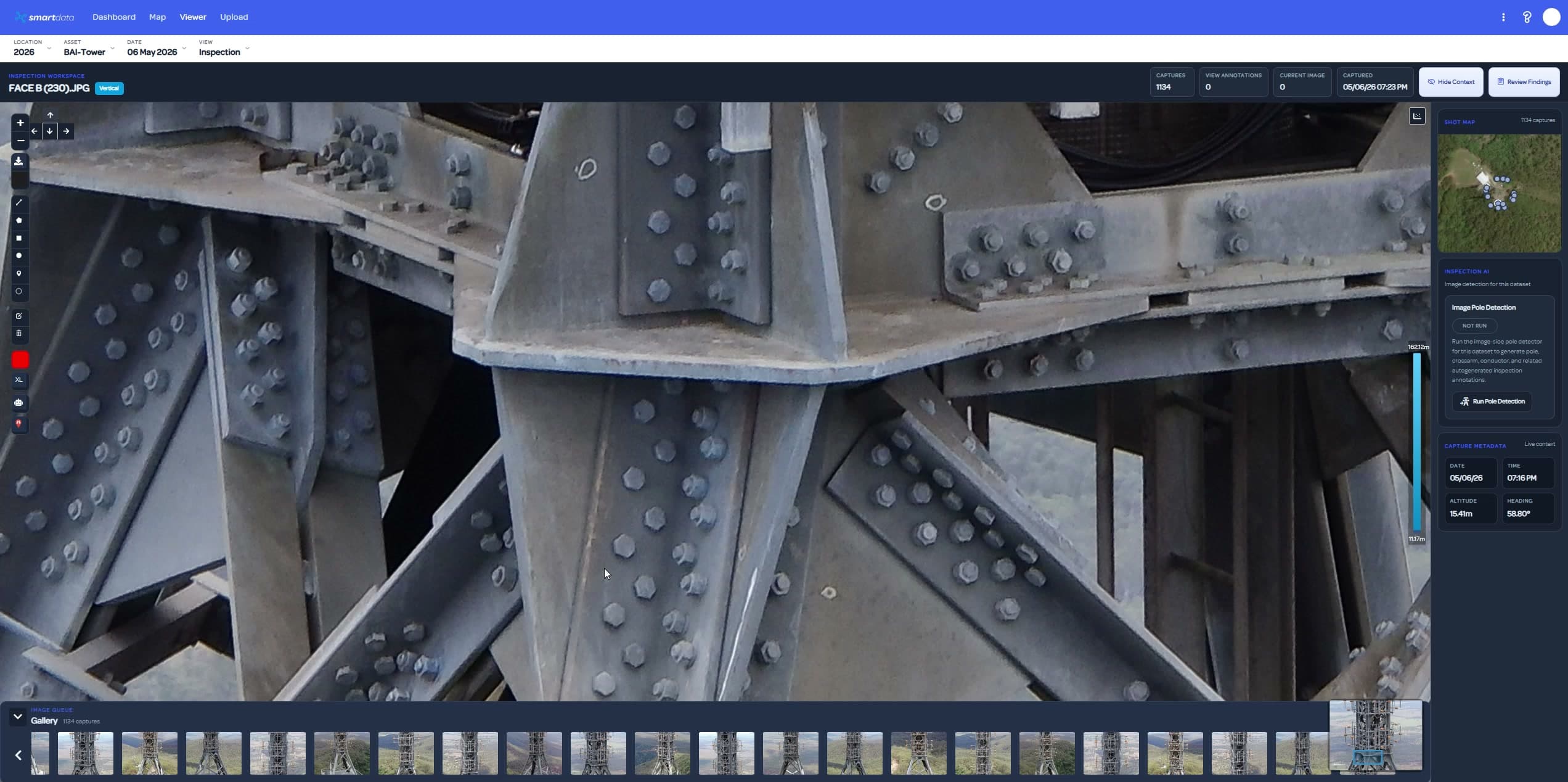
Use image, map, and 3D context to inspect tower components, access constraints, and maintenance evidence.
Create a repeatable review trail that can support contractors, engineers, and asset owners.
These SmartData tools support the workflows most relevant to telecommunications teams.
Review tower source imagery, annotations, and evidence with inspection status visible to the team.
View page
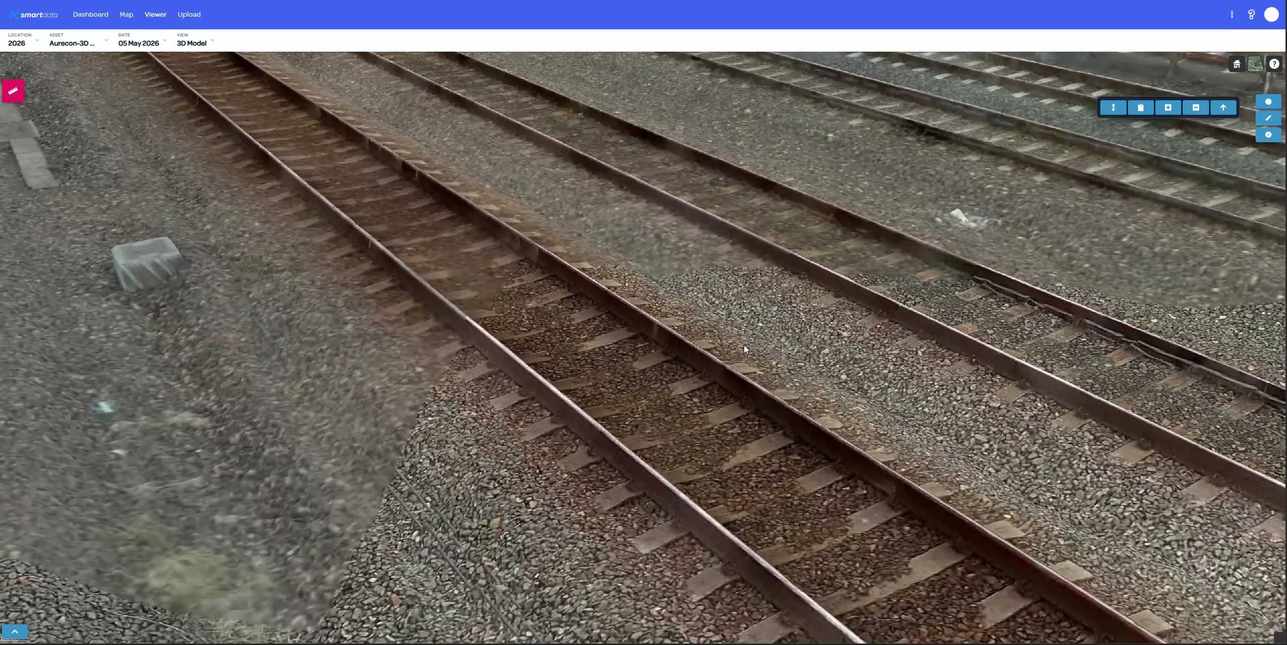
Inspect tower context with 3D models, point clouds, LiDAR, and Gaussian Splat visualisation.
View page
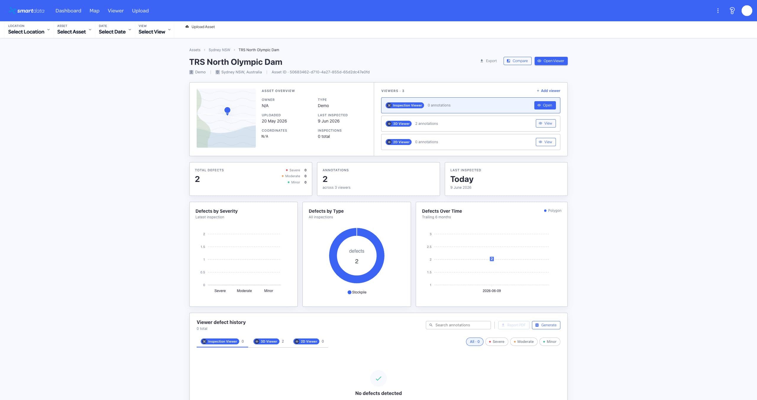
Keep tower inspection datasets, reports, users, and repeat capture history in one secure workspace.
View page
SmartData workflows often overlap across asset portfolios, corridors, sites, and environmental programs.
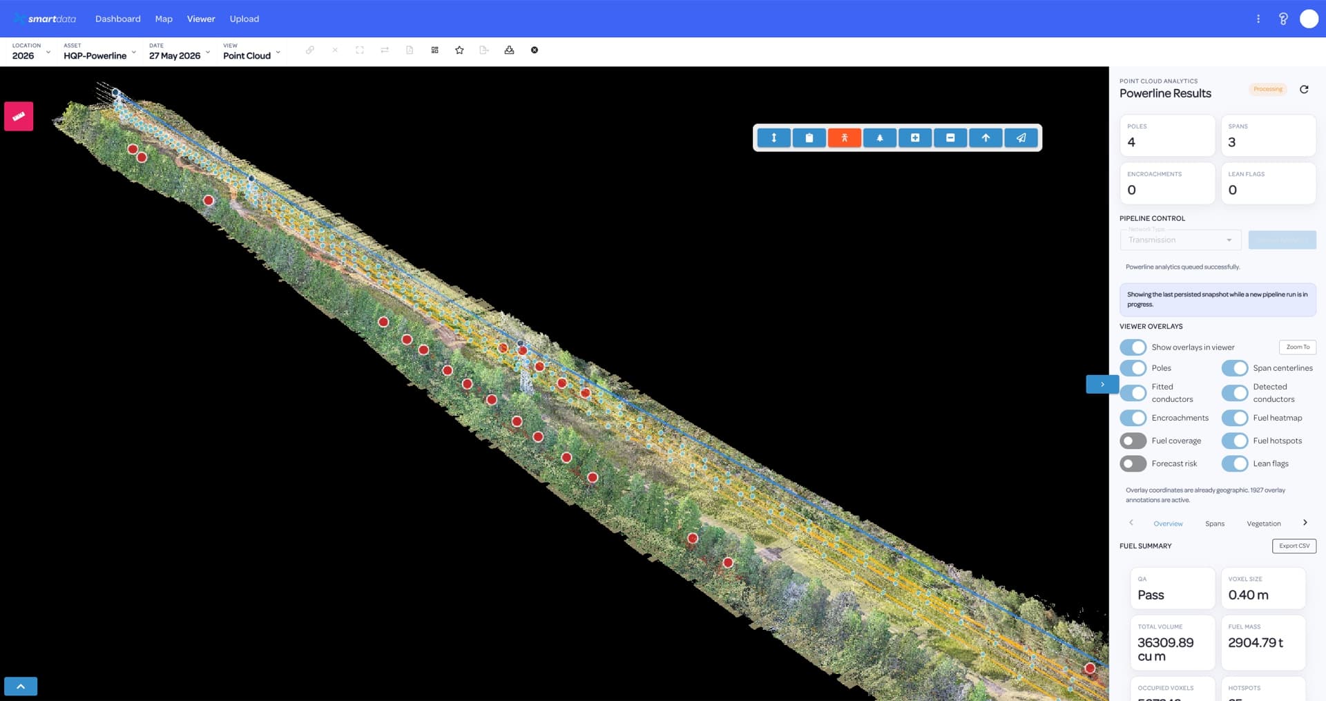
Utility teams need more than capture. SmartData keeps powerline inspection evidence, review status, spatial context, and reporting together so asset owners can move from defect discovery to planned action.
View page
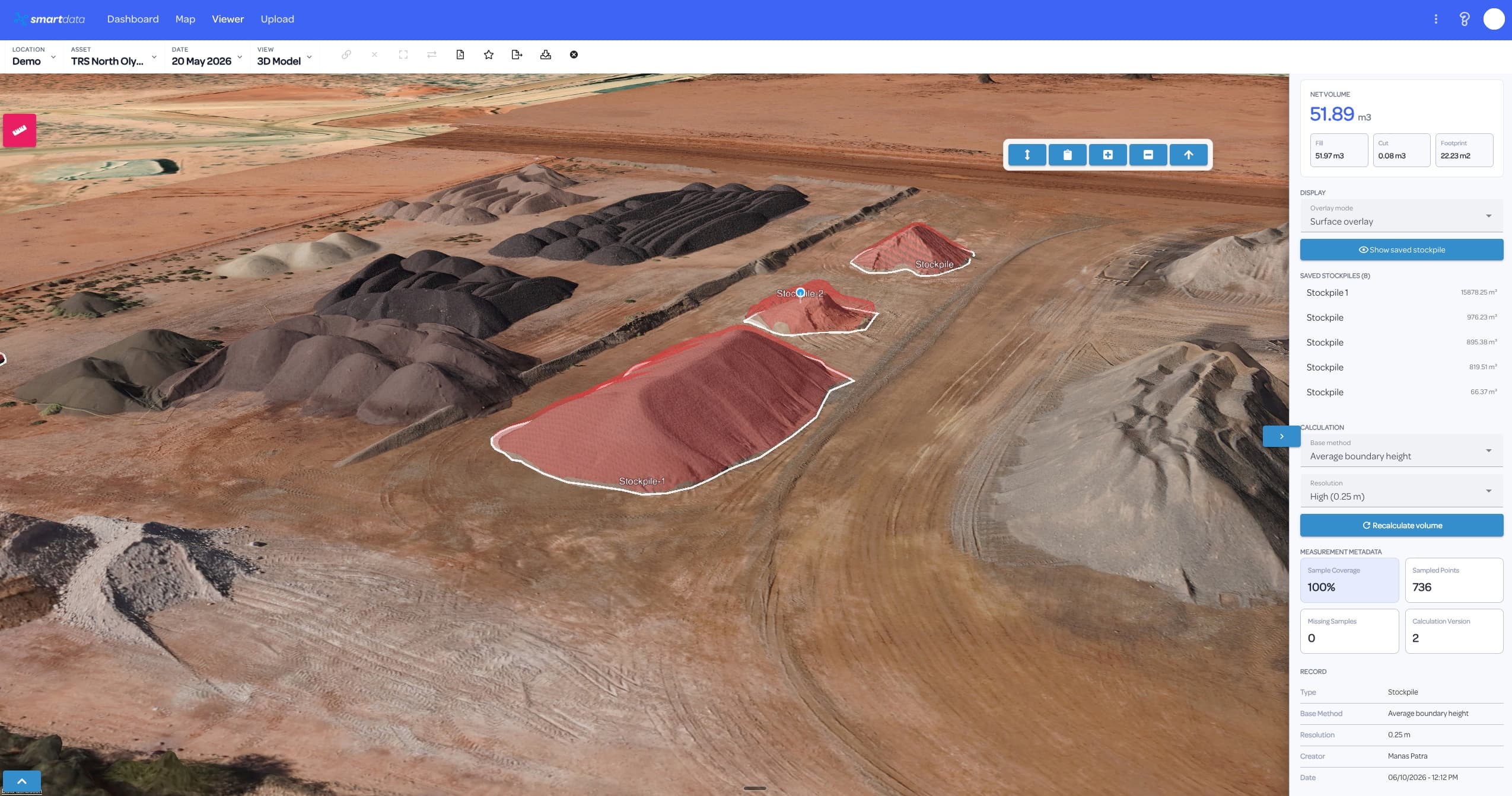
Mining and resources teams need repeatable spatial evidence across fast-changing sites. SmartData keeps maps, measurements, models, inspection records, and reports connected to the decisions they support.
View page
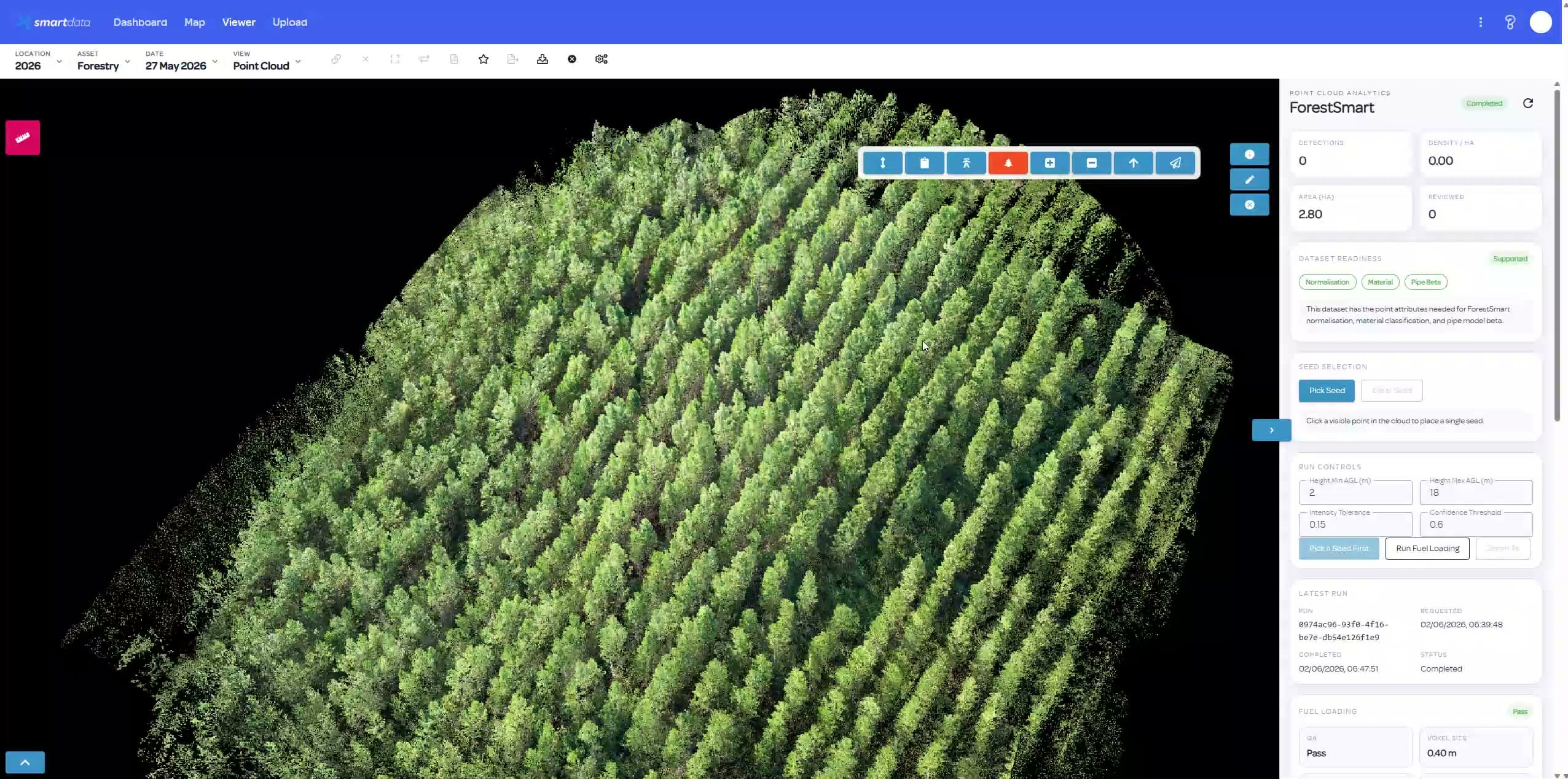
Forestry and environmental programs often rely on repeat captures, vegetation context, and field evidence. SmartData turns those datasets into accessible maps, review workflows, and reports.
View page
Bring a sample dataset, inspection workflow, or corridor problem. We will map the right SmartData path and show where the sandbox experience can support your own asset workflow.